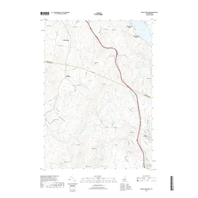
2018 Map of North Grantham
USGS Topo · Published 2018About this map
Lower Shaker Village and Upper Shaker Village sit along the southwestern shores of Mascoma Lake, marking a landscape deeply rooted in the communal history of the Grafton and Sullivan county borderlands. The terrain is defined by a series of prominent rises including Shaker Mtn, Methodist Hill, and the expansive Croydon Mtn, which dominate the central and southern portions of the quadrangle. A network of early transit routes and family-named roads, such as the Croyden Tpke, Methodist Hill Rd, and William Gage Rd, connects the scattered settlements of East Plainfield and North Grantham. This survey captures the rural character of the area where numerous high-altitude water bodies like Halfmile Pond, Chase Pond, and Lily Pond feed a complex system of drainages, including Skinner Brook and the south-flowing Newton Brook. Local history is further preserved in small landmarks like the Gleason Cem and the uniquely named Purmort Cem Ice Rd.
Find a feature on this map
77 named features on this map. Tap any name to fly to it.
Don’t see what you’re looking for? This feature index may not catch every label — zoom into the map to look around manually.
Map Details
Editions of this 2018 North Grantham Map
This is the sole edition of this map. No revisions or reprints were ever made.
Other maps of this area

1902 · Sunapee
USGS Topo · 1:62,500

1905 · Sunapee
USGS Topo · 1:62,500

1906 · Hanover
USGS Topo · 1:62,500

1907 · Sunapee
USGS Topo · 1:62,500

1908 · Hanover
USGS Topo · 1:62,500

1926 · Claremont
USGS Topo · 1:62,500

1927 · Mascoma
USGS Topo · 1:62,500

1929 · Claremont
USGS Topo · 1:62,500

1932 · Mascoma
USGS Topo · 1:62,500

1950 · Glens Falls
USGS Topo · 1:250,000