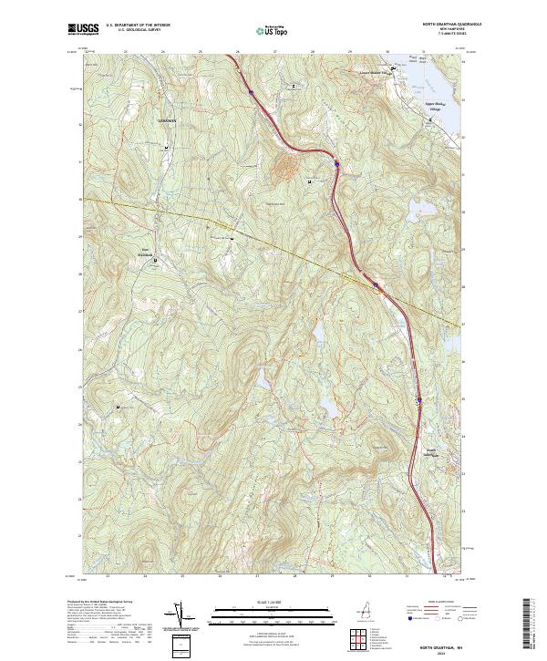
2024 Map of North Grantham
USGS Topo · Published 2024About this map
Lower Shaker Village and Upper Shaker Village anchor the northeastern landscape of this Sullivan County region, preserving the spatial footprint of historic Shaker communal life along the shores of Mascoma Lake. The terrain is defined by significant elevations like Croydon Mountain and Shaker Mountain, which hem in a network of drainage systems including Great Brook and Sawyer Brook. Local transit history is etched into the topography through labels like the Croydon Tpke and the Old Stage Coach Road Trl, indicating long-standing corridors through these New Hampshire highlands.
Find a feature on this map
102 named features on this map. Tap any name to fly to it.
Don’t see what you’re looking for? This feature index may not catch every label — zoom into the map to look around manually.
Map Details
Editions of this 2024 North Grantham Map
This is the sole edition of this map. No revisions or reprints were ever made.
Other maps of this area

1902 · Sunapee
USGS Topo · 1:62,500

1905 · Sunapee
USGS Topo · 1:62,500

1906 · Hanover
USGS Topo · 1:62,500

1907 · Sunapee
USGS Topo · 1:62,500

1908 · Hanover
USGS Topo · 1:62,500

1926 · Claremont
USGS Topo · 1:62,500

1927 · Mascoma
USGS Topo · 1:62,500

1929 · Claremont
USGS Topo · 1:62,500

1932 · Mascoma
USGS Topo · 1:62,500

1950 · Glens Falls
USGS Topo · 1:250,000