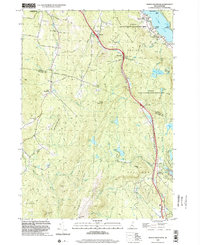
1998 Map of North Grantham
USGS Topo · Published 2002About this map
Lower Shaker Village and Upper Shaker Village anchor the northern reaches of this New Hampshire landscape, situated along the shores of Mascoma Lake. The map reveals a region defined by its communal history and conservation efforts, including the Enfield State Wildlife Management Area and the Annie Duncan State Forest. As Interstate 89 cuts through the terrain, it passes through small settlements like Purmort and Montcalm, where local history is preserved in sites like the Purmort Cem. To the west and south, the terrain rises toward Methodist Hill and Snow Mountain, with the rural communities of East Plainfield and North Grantham situated in the valleys. This late-twentieth-century survey documents the persistent rural character of the Sullivan and Grafton County border, showing the network of brooks like Stony Brook and Newton Brook that feed into numerous secluded ponds, including Smith Pond and Leavitt Pond.
Find a feature on this map
60 named features on this map. Tap any name to fly to it.
Don’t see what you’re looking for? This feature index may not catch every label — zoom into the map to look around manually.
Map Details
Editions of this 1998 North Grantham Map
This is the sole edition of this map. No revisions or reprints were ever made.
Other maps of this area

1902 · Sunapee
USGS Topo · 1:62,500

1905 · Sunapee
USGS Topo · 1:62,500

1906 · Hanover
USGS Topo · 1:62,500

1907 · Sunapee
USGS Topo · 1:62,500

1908 · Hanover
USGS Topo · 1:62,500

1926 · Claremont
USGS Topo · 1:62,500

1927 · Mascoma
USGS Topo · 1:62,500

1929 · Claremont
USGS Topo · 1:62,500

1932 · Mascoma
USGS Topo · 1:62,500

1950 · Glens Falls
USGS Topo · 1:250,000