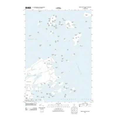
2011 Map of North Haven East
USGS Topo · Published 2011About this map
Goose Rocks Lighthouse stands as a maritime sentinel within the Fox Islands Thorofare, marking the watery divide between North Haven Island and the surrounding reaches of East Penobscot Bay. This coastal survey captures the island's intricate geography of coves and points, where maritime transportation remains central via the North Haven Ferry and its associated Ferry Dock. The interior landscape is dotted with several family and community burial grounds, including Seaview Cemetery, Kent Cemetery, and Witherspoon Cemetery, providing valuable data for genealogical research.
Find a feature on this map
125 named features on this map. Tap any name to fly to it.
Don’t see what you’re looking for? This feature index may not catch every label — zoom into the map to look around manually.
Map Details
Editions of this 2011 North Haven East Map
This is the sole edition of this map. No revisions or reprints were ever made.
Other maps of this area

1902 · Castine
USGS Topo · 1:62,500

1904 · Deer Isle
USGS Topo · 1:62,500

1904 · Castine
USGS Topo · 1:62,500

1904 · Bluehill
USGS Topo · 1:62,500

1904 · Vinalhaven
USGS Topo · 1:62,500

1905 · Penobscot Bay
USGS Topo · 1:125,000

1941 · Castine
USGS Topo · 1:62,500

1941 · Vinalhaven
USGS Topo · 1:62,500

1942 · Deer Isle
USGS Topo · 1:62,500
1943 · Castine
USGS Topo · 1:62,500