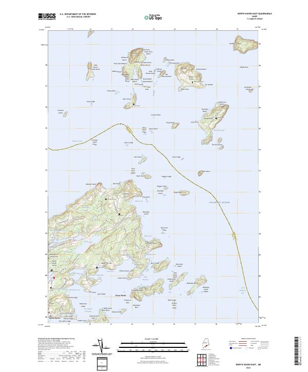
2024 Map of North Haven East
USGS Topo · Published 2024About this map
North Haven sits at the heart of this coastal island network in Penobscot Bay, serving as a hub for the archipelago's intricate maritime life. The landscape is defined by its deep coves and scattered family landmarks, where the North Haven Post Office and local roads like Main Rd and S Shore Rd connect the shoreline communities. Genealogists can find numerous burial sites across the islands, including Old Brown Cem, Frye Cem, and Quinn Cem on Eagle Island.
Find a feature on this map
134 named features on this map. Tap any name to fly to it.
Don’t see what you’re looking for? This feature index may not catch every label — zoom into the map to look around manually.
Map Details
Editions of this 2024 North Haven East Map
This is the sole edition of this map. No revisions or reprints were ever made.
Other maps of this area

1902 · Castine
USGS Topo · 1:62,500

1904 · Deer Isle
USGS Topo · 1:62,500

1904 · Castine
USGS Topo · 1:62,500

1904 · Bluehill
USGS Topo · 1:62,500

1904 · Vinalhaven
USGS Topo · 1:62,500

1905 · Penobscot Bay
USGS Topo · 1:125,000

1941 · Castine
USGS Topo · 1:62,500

1941 · Vinalhaven
USGS Topo · 1:62,500

1942 · Deer Isle
USGS Topo · 1:62,500
1943 · Castine
USGS Topo · 1:62,500