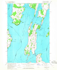
1966 Map of North Hero
USGS Topo · Published 1968About this map
North Hero and Isle La Motte dominate this landscape, where the waters of Lake Champlain define the geography of the islands. The map details an era when an Old Railroad Grade still traced the spine of the Alburg Tongue, crossing Alburg Passage to reach the mainland. Agricultural and industrial patterns are visible through numerous land-use markers, including several quarries on the western shores and a Gravel Pit near Macomb Bay. Local genealogy and settlement history are anchored by landmarks such as the North Hero Sch, Jerusalem Cem, and Hyde Cem. The intricate shoreline is heavily documented with family-named points and bays, from Fisk Point to Hazen Point, illustrating a community deeply connected to the lake's navigation and resources.
Find a feature on this map
78 named features on this map. Tap any name to fly to it.
Don’t see what you’re looking for? This feature index may not catch every label — zoom into the map to look around manually.
Map Details
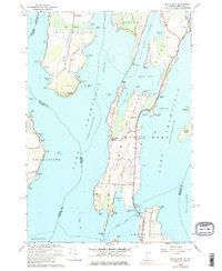
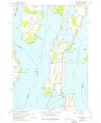
Editions of this 1966 North Hero Map
3 editions found
Other maps of this area

1894 · Plattsburg
USGS Topo · 1:62,500

1895 · Rouse Point
USGS Topo · 1:62,500

1906 · Plattsburg
USGS Topo · 1:62,500

1907 · Rouse Point
USGS Topo · 1:62,500

1913 · Milton
USGS Topo · 1:48,000

1914 · St. Albans
USGS Topo · 1:48,000

1915 · Milton
USGS Topo · 1:62,500

1916 · St. Albans
USGS Topo · 1:62,500

1939 · Rouses Point
USGS Topo · 1:62,500

1939 · Plattsburg
USGS Topo · 1:62,500