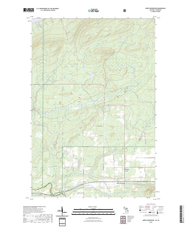
2023 Map of North Ironwood
USGS Topo · Published 2023About this map
Ottawa National Forest dominates the northern half of this landscape, where the North Country National Scenic Trl winds through a dense network of waterways like Spirit Creek and Foley Creek. The topography is defined by the drainage systems feeding toward Lake Superior, characterized by numerous small lakes and creeks including Spirit Lake and Montana Creek. To the south, the terrain transitions into a more developed rural pattern of section-line roads and small settlements.
Find a feature on this map
47 named features on this map. Tap any name to fly to it.
Don’t see what you’re looking for? This feature index may not catch every label — zoom into the map to look around manually.
Map Details
Editions of this 2023 North Ironwood Map
This is the sole edition of this map. No revisions or reprints were ever made.
Other maps of this area

1940 · Upson
USGS Topo · 1:48,000

1943 · Little Girls Point
USGS Topo · 1:24,000

1943 · Upson
USGS Topo · 1:48,000

1943 · Ironwood
USGS Topo · 1:48,000

1943 · Little Girl Point
USGS Topo · 1:48,000

1953 · Ashland
USGS Topo · 1:250,000

1955 · Ironwood
USGS Topo · 1:24,000

1955 · Bessemer
USGS Topo · 1:24,000

1955 · Ironwood
USGS Topo · 1:62,500

1956 · North Ironwood
USGS Topo · 1:62,500