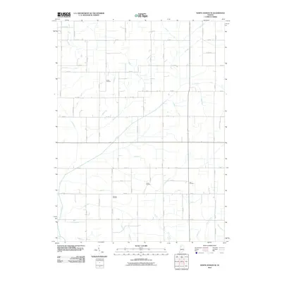
2010 Map of North Judson SE
USGS Topo · Published 2010About this map
The low-lying fields of Pulaski County are defined by an intricate network of engineered drainage, illustrating the mid-century agricultural transformation of the Indiana landscape. Waterways such as Monon Ditch, Wills Ditch, and Scholtz Ditch follow a rigid, surveyed grid, carving paths through the rural township to manage the high water table. This systematic approach to hydrology turned the region into a productive farming hub, where local roads now strictly adhere to the section lines established by these channels.
Find a feature on this map
71 named features on this map. Tap any name to fly to it.
Don’t see what you’re looking for? This feature index may not catch every label — zoom into the map to look around manually.
Map Details
Editions of this 2010 North Judson SE Map
This is the sole edition of this map. No revisions or reprints were ever made.
Other maps of this area

1953 · Chicago
USGS Topo · 1:250,000

1953 · Danville
USGS Topo · 1:250,000

1955 · Danville
USGS Topo · 1:250,000

1956 · Danville
USGS Topo · 1:250,000

1957 · Chicago
USGS Topo · 1:250,000

1959 · North Judson
USGS Topo · 1:24,000

1959 · San Pierre
USGS Topo · 1:24,000

1962 · Buffalo
USGS Topo · 1:24,000

1962 · Monon NE
USGS Topo · 1:24,000

1962 · Medaryville
USGS Topo · 1:24,000