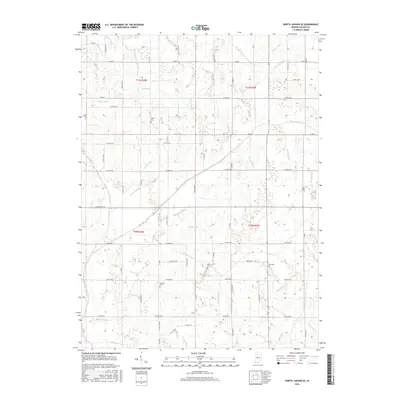
2016 Map of North Judson SE
USGS Topo · Published 2016About this map
Hydrological engineering dominates this portion of Pulaski County, where an intricate network of drainage canals has historically managed the local water table for agriculture. The Big Monon Ditch and its numerous tributaries, including Guild Ditch and Lincoln Ditch, cut across the landscape in a rigid, geometric pattern that reflects the region's conversion from wetlands to productive farmland. This system of ditches, such as the Scholtz Ditch and Dressler Ditch, defines the terrain between the sections of the Public Land Survey System.
Find a feature on this map
80 named features on this map. Tap any name to fly to it.
Don’t see what you’re looking for? This feature index may not catch every label — zoom into the map to look around manually.
Map Details
Editions of this 2016 North Judson SE Map
This is the sole edition of this map. No revisions or reprints were ever made.
Other maps of this area

1953 · Chicago
USGS Topo · 1:250,000

1953 · Danville
USGS Topo · 1:250,000

1955 · Danville
USGS Topo · 1:250,000

1956 · Danville
USGS Topo · 1:250,000

1957 · Chicago
USGS Topo · 1:250,000

1959 · North Judson
USGS Topo · 1:24,000

1959 · San Pierre
USGS Topo · 1:24,000

1962 · Buffalo
USGS Topo · 1:24,000

1962 · Monon NE
USGS Topo · 1:24,000

1962 · Medaryville
USGS Topo · 1:24,000