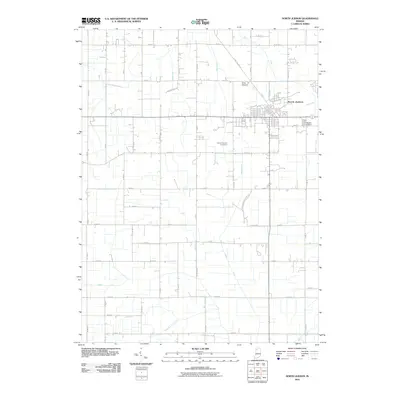
2010 Map of North Judson
USGS Topo · Published 2010About this map
North Judson serves as the primary hub of this landscape, situated at a junction of roads and rail lines that once drove the local economy. The surrounding terrain is defined by an intricate network of engineered waterways, such as the Monon Ditch, Green Ditch, and Stromberg-Tetzloff Ditch, reflecting a long history of land reclamation and water management for agriculture. Natural features like Pine Creek weave through this system of straight-line ditches, illustrating the transition from marshland to productive farmland. For those researching local family history, the map provides precise locations for Highland Cemetery and Saint Thomas Cemetery. The presence of Long Airport northwest of the town center and the alignment of the Rensselaer Trl further mark the area's development and transportation patterns as they existed in the early 21st century.
Find a feature on this map
60 named features on this map. Tap any name to fly to it.
Don’t see what you’re looking for? This feature index may not catch every label — zoom into the map to look around manually.
Map Details
Editions of this 2010 North Judson Map
This is the sole edition of this map. No revisions or reprints were ever made.
Other maps of this area

1953 · Chicago
USGS Topo · 1:250,000

1957 · Chicago
USGS Topo · 1:250,000

1957 · Knox West
USGS Topo · 1:24,000

1958 · La Crosse
USGS Topo · 1:24,000

1959 · English Lake
USGS Topo · 1:24,000

1959 · North Judson
USGS Topo · 1:24,000

1959 · San Pierre
USGS Topo · 1:24,000

1962 · Medaryville
USGS Topo · 1:24,000

1962 · Denham
USGS Topo · 1:24,000
1962 · Ripley
USGS Topo · 1:24,000