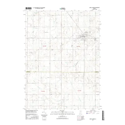
2016 Map of North Judson
USGS Topo · Published 2016About this map
North Judson serves as the central hub of this agricultural landscape, where the grid of Starke and Pulaski counties meets a complex system of drainage infrastructure. This 2016 survey illustrates the precision of modern Indiana land management, defined by the numerous watercourses like Big Monon Ditch, Pine Cr, and Green Ditch that crisscross the fertile plains. These ditches, including the Barker Ditch and Schultz Ditch, reveal the extensive engineering required to sustain the region's farming heritage.
Find a feature on this map
58 named features on this map. Tap any name to fly to it.
Don’t see what you’re looking for? This feature index may not catch every label — zoom into the map to look around manually.
Map Details
Editions of this 2016 North Judson Map
This is the sole edition of this map. No revisions or reprints were ever made.
Other maps of this area

1953 · Chicago
USGS Topo · 1:250,000

1957 · Chicago
USGS Topo · 1:250,000

1957 · Knox West
USGS Topo · 1:24,000

1958 · La Crosse
USGS Topo · 1:24,000

1959 · English Lake
USGS Topo · 1:24,000

1959 · North Judson
USGS Topo · 1:24,000

1959 · San Pierre
USGS Topo · 1:24,000

1962 · Medaryville
USGS Topo · 1:24,000

1962 · Denham
USGS Topo · 1:24,000
1962 · Ripley
USGS Topo · 1:24,000