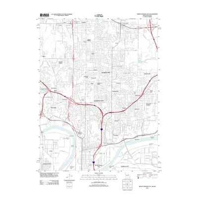
2012 Map of North Kansas City
USGS Topo · Published 2012About this map
The Missouri River defines the southern and western boundaries of this landscape, carving the distinctive Kaw Bend and the Kansas City Reach as it flows past the urban core. The Kansas City Downtown Airport occupies the low-lying peninsula south of the river, while the Kansas City Waterworks and Fairfax-Jersey Creek Levee Unit illustrate the extensive infrastructure required to manage the river's proximity to the city. To the north, the terrain transitions into a dense network of suburban developments and small incorporated areas.
Find a feature on this map
124 named features on this map. Tap any name to fly to it.
Don’t see what you’re looking for? This feature index may not catch every label — zoom into the map to look around manually.
Map Details
Editions of this 2012 North Kansas City Map
This is the sole edition of this map. No revisions or reprints were ever made.
Other maps of this area

1890 · Kansas City
USGS Topo · 1:125,000

1894 · Kansas City
USGS Topo · 1:125,000

1894 · Independence
USGS Topo · 1:125,000

1914 · Smithville
USGS Topo · 1:62,500

1934 · Independence
USGS Topo · 1:24,000

1934 · Shawnee
USGS Topo · 1:24,000

1935 · Kansas City
USGS Topo · 1:24,000

1935 · North Kansas City
USGS Topo · 1:24,000

1935 · Liberty
USGS Topo · 1:24,000

1936 · Kearney
USGS Topo · 1:48,000