
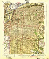
1935 Map of North Kansas City
USGS Topo · Published 1935About this map
The Missouri River corridor in the mid-1930s reveals a landscape of industrial expansion and residential suburbanization bridging Clay and Jackson counties. The developed grid of North Kansas City contrasts sharply with the winding bluffs to the north, where small communities like Gashland and Englewood are interspersed with family-named landmarks and local institutions such as Mt Olivet Ch and the New Stark Cem. This era captures the transition of the river bottomlands into a major transportation and utility hub, evidenced by the extensive C B and Q Yards and the Kansas City Missouri Water Works. Early aviation history is prominent here, with both the Fairfax Landing Field and Kansas City Landing Field serving the region before the age of major commercial hubs, while the Riverside Race Track stands as a notable recreational landmark on the northern bank.
Find a feature on this map
46 named features on this map. Tap any name to fly to it.
Don’t see what you’re looking for? This feature index may not catch every label — zoom into the map to look around manually.
Map Details
Editions of this 1935 North Kansas City Map
This is the sole edition of this map. No revisions or reprints were ever made.
Other maps of this area

1890 · Kansas City
USGS Topo · 1:125,000

1894 · Kansas City
USGS Topo · 1:125,000

1894 · Independence
USGS Topo · 1:125,000

1914 · Smithville
USGS Topo · 1:62,500

1934 · Independence
USGS Topo · 1:24,000

1934 · Shawnee
USGS Topo · 1:24,000

1935 · Kansas City
USGS Topo · 1:24,000

1935 · Liberty
USGS Topo · 1:24,000

1936 · Kearney
USGS Topo · 1:48,000
1940 · Kansas City
USGS Topo · 1:31,680