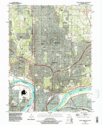
1990 Map of North Kansas City
USGS Topo · Published 1996About this map
North Kansas City and the surrounding suburban sprawl of Clay County are meticulously documented in this 1990 revision, reflecting decades of post-war development north of the Missouri River. The landscape is a dense network of residential communities such as Gladstone, Oakview, and Riverside, interwoven with remnants of the area's rural past. Long-standing local landmarks like Barry Cem and the New Stark Cem persist alongside modern institutional additions like Maple Woods Community College.
Find a feature on this map
45 named features on this map. Tap any name to fly to it.
Don’t see what you’re looking for? This feature index may not catch every label — zoom into the map to look around manually.
Map Details
Editions of this 1990 North Kansas City Map
This is the sole edition of this map. No revisions or reprints were ever made.
Other maps of this area

1890 · Kansas City
USGS Topo · 1:125,000

1894 · Kansas City
USGS Topo · 1:125,000

1894 · Independence
USGS Topo · 1:125,000

1914 · Smithville
USGS Topo · 1:62,500

1934 · Independence
USGS Topo · 1:24,000

1934 · Shawnee
USGS Topo · 1:24,000

1935 · Kansas City
USGS Topo · 1:24,000

1935 · North Kansas City
USGS Topo · 1:24,000

1935 · Liberty
USGS Topo · 1:24,000

1936 · Kearney
USGS Topo · 1:48,000