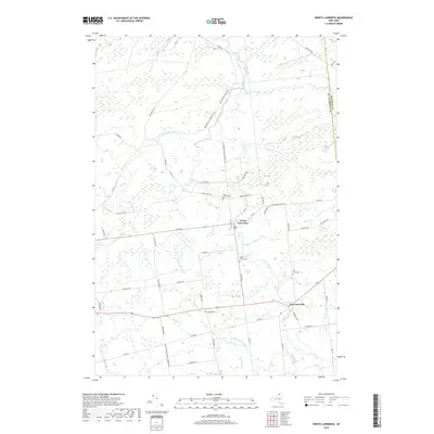
2019 Map of North Lawrence
USGS Topo · Published 2019About this map
North Lawrence and Lawrenceville serve as the primary anchors of this Northern New York landscape, situated where the Deer River and several significant brooks converge near the St. Lawrence Co Franklin Co line. The terrain is defined by a dense network of waterways, including Lawrence Brook, Trout Brook, and Redwater Brook, which likely influenced the historical settlement patterns of the township. Local heritage is deeply embedded in the land through numerous small burial grounds, such as Maple Grove Cem, Hallville Cem, Hill Crest Cem, and Flint-Chaffee Cem, each marking a legacy of the families who established farms along the rural road system. This road network, featuring names like Leary Flint Rd and N Lawrence Maria Rd, suggests a long history of local commerce and connectivity between the river valley and the surrounding agricultural tracts.
Find a feature on this map
52 named features on this map. Tap any name to fly to it.
Don’t see what you’re looking for? This feature index may not catch every label — zoom into the map to look around manually.
Map Details
Editions of this 2019 North Lawrence Map
This is the sole edition of this map. No revisions or reprints were ever made.
Other maps of this area

1906 · Massena
USGS Topo · 1:62,500

1907 · Massena
USGS Topo · 1:62,500

1908 · Potsdam
USGS Topo · 1:62,500

1915 · Moira
USGS Topo · 1:62,500

1917 · Moira
USGS Topo · 1:62,500

1919 · Nicholville
USGS Topo · 1:62,500

1921 · Nicholville
USGS Topo · 1:62,500
1943 · Parishville
USGS Topo · 1:31,680

1944 · Moira
USGS Topo · 1:62,500
1946 · Brasher Falls
USGS Topo · 1:24,000