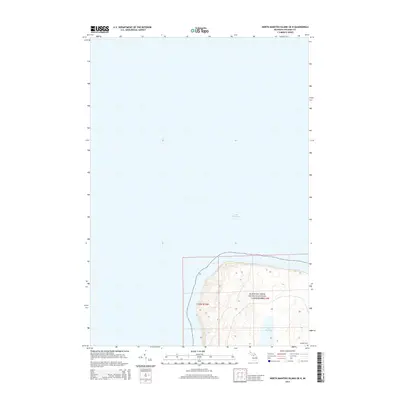
2014 Map of North Manitou Island OE N
USGS Topo · Published 2014About this map
Lake Manitou rests within the northern interior of North Manitou Island, a significant freshwater feature nearly encircled by the steep elevations of the Sleeping Bear Dunes National Lakeshore. This survey of the island's northeast corner captures a landscape of dramatic topography where the dunes meet the waters of Lake Michigan. In the southeastern corner of the quadrangle, the presence of Mongoo Cem provides a specific point of interest for those researching local history or island genealogy. The map clearly delineates the Public Land Survey System grid with sections of t32n r15w and r14w, illustrating the intersection of protected national parkland and the rugged shoreline of Leelanau County.
Find a feature on this map
6 named features on this map. Tap any name to fly to it.
Don’t see what you’re looking for? This feature index may not catch every label — zoom into the map to look around manually.
Map Details
Editions of this 2014 North Manitou Island OE N Map
This is the sole edition of this map. No revisions or reprints were ever made.
Other maps of this area

1954 · Escanaba
USGS Topo · 1:250,000

1955 · Cheboygan
USGS Topo · 1:250,000

1956 · North Manitou
USGS Topo · 1:62,500

1956 · South Fox Island
USGS Topo · 1:62,500

1957 · Escanaba
USGS Topo · 1:250,000

1958 · Escanaba
USGS Topo · 1:250,000

1958 · Cheboygan
USGS Topo · 1:250,000
1983 · North Manitou Island
USGS Topo · 1:25,000

1984 · Washington Island
USGS Topo · 1:100,000

1984 · Charlevoix
USGS Topo · 1:100,000