
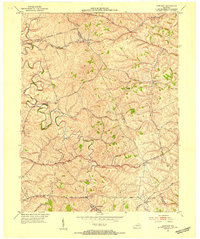
1952 Map of North Middletown
USGS Topo · Published 1953About this map
The Cane Ridge Meetinghouse stands as a focal point in the northwest corner of this mid-century survey, a site of significant religious history in Bourbon County. This landscape is defined by the winding course of Hinkston Creek, which serves as a natural boundary between Bourbon and Nicholas counties. The map captures a detailed view of the rural Bluegrass region, where narrow roads like Harrods Road connect small settlements such as Little Rock and Jackstown.
Find a feature on this map
29 named features on this map. Tap any name to fly to it.
Don’t see what you’re looking for? This feature index may not catch every label — zoom into the map to look around manually.
Map Details
Editions of this 1952 North Middletown Map
This is the sole edition of this map. No revisions or reprints were ever made.
Other maps of this area

1952 · Sharpsburg
USGS Topo · 1:24,000

1952 · Paris East
USGS Topo · 1:24,000

1952 · Mount Sterling
USGS Topo · 1:24,000

1952 · Austerlitz
USGS Topo · 1:24,000
1952 · Sideview
USGS Topo · 1:24,000

1953 · Carlisle
USGS Topo · 1:24,000

1953 · Moorefield
USGS Topo · 1:24,000

1953 · Millersburg
USGS Topo · 1:24,000

1956 · Louisville
USGS Topo · 1:250,000

1957 · Huntington
USGS Topo · 1:250,000