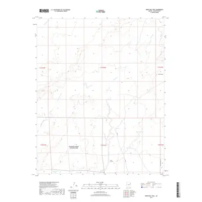
2018 Map of North Mill Well
USGS Topo · Published 2018About this map
Petrified Forest National Park extends into the southern portion of this Apache County landscape, where the high desert terrain is defined by a network of seasonal drainages and stock tanks. The map captures an arid expanse characterized by the shifting sands and plateaus of Padres Mesa, with prominent watercourses like Wide Ruin Wash and Lithodendron Wash carving through the township boundaries. Local infrastructure is minimal, centered on ranching and land management features such as the namesake North Mill Well and several strategically placed reservoirs including Mark One Tank, Mark Two Tank, and Big Tank. Tracing the paths of Pinta Rd and Sweetwater Ranch Rd, one can see the established routes through this part of the Fort Defiance Agency, where the relationship between scarce water resources and land use is clearly visible.
Find a feature on this map
19 named features on this map. Tap any name to fly to it.
Don’t see what you’re looking for? This feature index may not catch every label — zoom into the map to look around manually.
Map Details
Editions of this 2018 North Mill Well Map
This is the sole edition of this map. No revisions or reprints were ever made.
Other maps of this area

1886 · Fort Defiance
USGS Topo · 1:250,000

1892 · Fort Defiance
USGS Topo · 1:250,000

1954 · Gallup
USGS Topo · 1:250,000

1958 · Gallup
USGS Topo · 1:250,000

1959 · Gallup
USGS Topo · 1:250,000

1962 · Gallup
USGS Topo · 1:250,000

1967 · Gallup
USGS Topo · 1:250,000
1972 · Tanner Springs
USGS Topo · 1:24,000
1972 · Navajo North
USGS Topo · 1:24,000
1972 · Navajo South
USGS Topo · 1:24,000