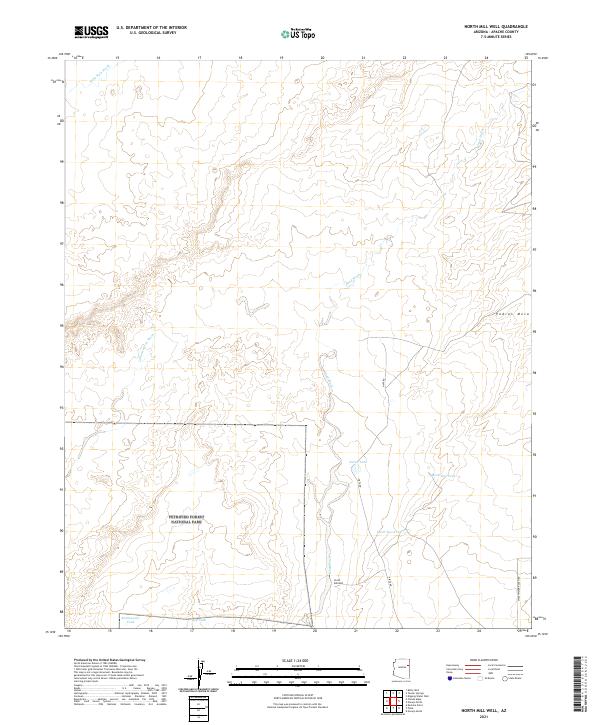
2021 Map of North Mill Well
USGS Topo · Published 2021About this map
Petrified Forest National Park occupies the southwestern corner of this high-desert landscape in Apache County, where the terrain is defined by an intricate network of intermittent watercourses. The drainage of Dead Wash dominates the central corridor, joined by tributaries like Lithodendron Wash and Wide Ruin Wash further north. This area relies on a system of livestock water management, evidenced by named features such as North Tank, Mark One Tank, and Mark Two Tank. The namesake North Mill Well sits near the crossing of Pinta Rd, indicating a vital point of water access in an otherwise arid expanse. To the northeast, the elevation rises toward Padres Mesa, while the southern border is traced by Sweetwater Ranch Rd near Big Tank and Rattlesnake Tank.
Find a feature on this map
19 named features on this map. Tap any name to fly to it.
Don’t see what you’re looking for? This feature index may not catch every label — zoom into the map to look around manually.
Map Details
Editions of this 2021 North Mill Well Map
This is the sole edition of this map. No revisions or reprints were ever made.
Other maps of this area

1886 · Fort Defiance
USGS Topo · 1:250,000

1892 · Fort Defiance
USGS Topo · 1:250,000

1954 · Gallup
USGS Topo · 1:250,000

1958 · Gallup
USGS Topo · 1:250,000

1959 · Gallup
USGS Topo · 1:250,000

1962 · Gallup
USGS Topo · 1:250,000

1967 · Gallup
USGS Topo · 1:250,000
1972 · Tanner Springs
USGS Topo · 1:24,000
1972 · Navajo North
USGS Topo · 1:24,000
1972 · Navajo South
USGS Topo · 1:24,000