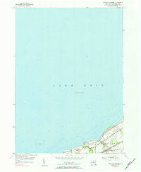
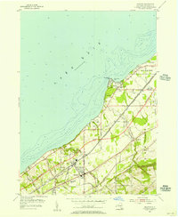
1955 Map of North Of Dunkirk
USGS Topo · Published 1984About this map
Lake Erie dominates this mid-century topographic perspective of the shoreline northeast of Dunkirk. The map details a narrow but vital strip of land where intensive transportation and community infrastructure concentrate along the coast. Three major rail lines—the New York Central, the Chicago and St Louis, and the Pennsylvania—run in parallel through the town of Sheridan, illustrating the historical importance of this corridor for industrial transit between major eastern and midwestern hubs.
Find a feature on this map
18 named features on this map. Tap any name to fly to it.
Don’t see what you’re looking for? This feature index may not catch every label — zoom into the map to look around manually.
Map Details
Editions of this 1955 North Of Dunkirk Map
Other maps of this area

1899 · Silver Creek
USGS Topo · 1:62,500

1900 · Dunkirk
USGS Topo · 1:62,500

1900 · Cherry Creek
USGS Topo · 1:62,500

1941 · Cherry Creek
USGS Topo · 1:62,500

1943 · Dunkirk
USGS Topo · 1:62,500

1943 · Silver Creek
USGS Topo · 1:24,000

1944 · Silver Creek
USGS Topo · 1:31,680

1954 · Forestville
USGS Topo · 1:24,000
1954 · Dunkirk
USGS Topo · 1:24,000
1954 · Brocton
USGS Topo · 1:24,000