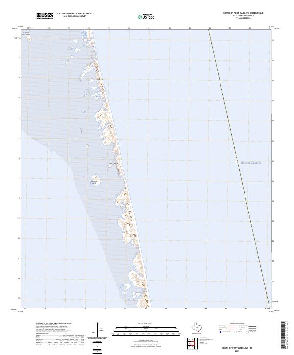
2025 Map of North of Port Isabel SW
USGS Topo · Published 2025About this map
Padre Island dominates this coastal survey, showing the intricate interface between the barrier island's western flats and the surrounding lagoons. The topography here is defined by low-lying wetland features and shifting sands, with significant landforms such as La Punta Larga and Los Tanques marking the interior terrain. These names suggest a long history of maritime and ranching influence in this part of South Texas, where the landscape is constantly reshaped by the elements. To the north, Los Bencos de en Medio represents the specialized coastal geomorphology of the region. The eastern edge of the map opens onto the Gulf of America, providing a clear look at the shoreline before any modern development or major infrastructure reached this specific reach of the island.
Find a feature on this map
5 named features on this map. Tap any name to fly to it.
Don’t see what you’re looking for? This feature index may not catch every label — zoom into the map to look around manually.
Map Details
Editions of this 2025 North of Port Isabel SW Map
This is the sole edition of this map. No revisions or reprints were ever made.
Other maps of this area

1929 · La Coma
USGS Topo · 1:24,000

1929 · Buena Vista
USGS Topo · 1:24,000

1930 · Padre Island No. 1
USGS Topo · 1:24,000

1930 · Padre Island No. 2
USGS Topo · 1:24,000

1934 · La Coma
USGS Topo · 1:31,680

1935 · Padre Island No 1
USGS Topo · 1:31,680

1935 · Padre Island NO. 2
USGS Topo · 1:31,680

1935 · Buena Vista
USGS Topo · 1:31,680

1952 · Green Island
USGS Topo · 1:24,000
1952 · North Of Port Isabel NW
USGS Topo · 1:24,000