
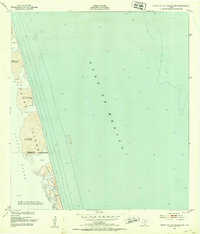
1930 Map of Padre Island No. 2
USGS Topo · Published 1930About this map
Padre Island appears as a narrow, shifting barrier in this early 20th-century coastal survey. Compiled from aerial photographs taken by the Air Corps, U.S. Army, the map provides a look at the littoral landscape before significant modern development. The geography is dominated by the sprawling Mud Flats that transition into the shallow waters of the Laguna Madre to the west. This advance sheet emphasizes the natural boundary between the lagoon and the open Gulf of Mexico, capturing the desolate, wind-swept character of the Texas coast during this era. The lack of infrastructure or man-made landmarks on the island itself underscores the isolation of the region at the time of the 1930 compilation.
Find a feature on this map
4 named features on this map. Tap any name to fly to it.
Don’t see what you’re looking for? This feature index may not catch every label — zoom into the map to look around manually.
Map Details
Editions of this 1930 Padre Island No. 2 Map
This is the sole edition of this map. No revisions or reprints were ever made.
Other maps of this area

1929 · La Coma
USGS Topo · 1:24,000

1929 · Buena Vista
USGS Topo · 1:24,000

1930 · Padre Island No. 1
USGS Topo · 1:24,000

1934 · La Coma
USGS Topo · 1:31,680

1935 · Padre Island No 1
USGS Topo · 1:31,680

1935 · Padre Island NO. 2
USGS Topo · 1:31,680

1935 · Buena Vista
USGS Topo · 1:31,680

1952 · Green Island
USGS Topo · 1:24,000
1952 · North Of Port Isabel NW
USGS Topo · 1:24,000

1953 · Brownsville
USGS Topo · 1:250,000