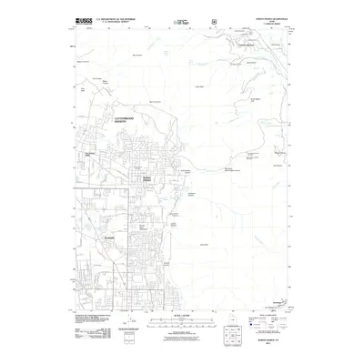
2011 Map of North Ogden
USGS Topo · Published 2011About this map
North Ogden and Harrisville anchor the suburban and rural landscape of northern Weber County in this 2011 survey. The transition from the developed valley floor to the peaks of the Wasatch Range is abrupt, defined by a series of steep drainages such as North Ogden Canyon and Jumpoff Canyon. Local history is preserved at the Ben Lomond Cemetery, while the northern residential expansion into Pleasant View and Cottonwood Heights is documented through a dense network of numbered streets and residential tracts like Mount Eyrie Meadows.
Find a feature on this map
128 named features on this map. Tap any name to fly to it.
Don’t see what you’re looking for? This feature index may not catch every label — zoom into the map to look around manually.
Map Details
Editions of this 2011 North Ogden Map
This is the sole edition of this map. No revisions or reprints were ever made.
Other maps of this area

1954 · Ogden
USGS Topo · 1:250,000

1954 · Brigham City
USGS Topo · 1:250,000

1955 · Ogden
USGS Topo · 1:24,000

1955 · Plain City
USGS Topo · 1:24,000

1955 · Roy
USGS Topo · 1:24,000

1955 · Mantua
USGS Topo · 1:24,000

1955 · Huntsville
USGS Topo · 1:24,000

1955 · James Peak
USGS Topo · 1:24,000

1955 · Willard
USGS Topo · 1:24,000

1955 · North Ogden
USGS Topo · 1:24,000