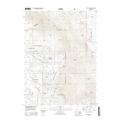
2014 Map of North Ogden
USGS Topo · Published 2014About this map
North Ogden and Pleasant View sit at the base of the Wasatch Range, where residential expansion meets the high-elevation wilderness of the Cache National Forest. This 2014 survey captures a landscape defined by sharp transitions from suburban neighborhoods to steep, drainage-carved terrain. The map records the proximity of local landmarks like Ben Lomond Cem to the rising slopes of Ben Lomond and Lewis Peak. Below these summits, numerous canyons such as One Horse Canyon, Garner Canyon, and Jumpoff Canyon provide natural pathways for water to descend toward the valley floor. The map also identifies newer developments like Mount Eyrie Meadows, illustrating the modern urban-wildland interface that characterizes this part of Ogden. Local water features, including Fourmile Cr and Cold Springs, underscore the vital role of mountain runoff in supporting the communities below.
Find a feature on this map
148 named features on this map. Tap any name to fly to it.
Don’t see what you’re looking for? This feature index may not catch every label — zoom into the map to look around manually.
Map Details
Editions of this 2014 North Ogden Map
This is the sole edition of this map. No revisions or reprints were ever made.
Other maps of this area
1954 · Ogden
USGS Topo · 1:250,000
1954 · Brigham City
USGS Topo · 1:250,000
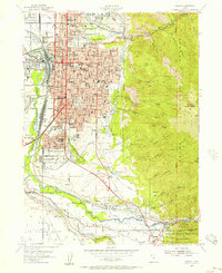
1955 · Ogden
USGS Topo · 1:24,000
1955 · Plain City
USGS Topo · 1:24,000
1955 · Roy
USGS Topo · 1:24,000
1955 · Mantua
USGS Topo · 1:24,000
1955 · Huntsville
USGS Topo · 1:24,000
1955 · James Peak
USGS Topo · 1:24,000
1955 · Willard
USGS Topo · 1:24,000
1955 · North Ogden
USGS Topo · 1:24,000