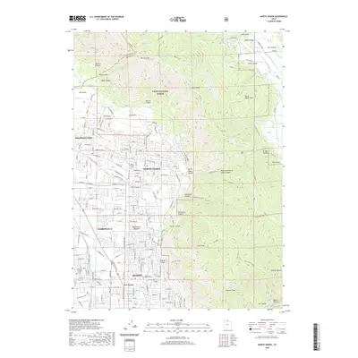
2020 Map of North Ogden
USGS Topo · Published 2020About this map
North Ogden and Pleasant View anchor the suburban landscape at the foot of the Wasatch Range, where residential developments meet the steep ascent into the Cache National Forest. The map documents a clear transition from the urban grid of Ogden and the historic crossroads of Five Points to the high-elevation peaks of Ben Lomond and Lewis Peak. Researchers can trace the interface of modern infrastructure, such as Skyline Dr, with numerous natural drainages including North Ogden Canyon and Coldwater Canyon. The proximity of the Ben Lomond Cem and Evergreen Memorial Park to expanding neighborhoods like Mount Eyrie Meadows illustrates the continued growth of Weber County against its formidable mountain backdrop.
Find a feature on this map
121 named features on this map. Tap any name to fly to it.
Don’t see what you’re looking for? This feature index may not catch every label — zoom into the map to look around manually.
Map Details
Editions of this 2020 North Ogden Map
This is the sole edition of this map. No revisions or reprints were ever made.
Other maps of this area

1954 · Ogden
USGS Topo · 1:250,000

1954 · Brigham City
USGS Topo · 1:250,000

1955 · Ogden
USGS Topo · 1:24,000

1955 · Plain City
USGS Topo · 1:24,000

1955 · Roy
USGS Topo · 1:24,000

1955 · Mantua
USGS Topo · 1:24,000

1955 · Huntsville
USGS Topo · 1:24,000

1955 · James Peak
USGS Topo · 1:24,000

1955 · Willard
USGS Topo · 1:24,000

1955 · North Ogden
USGS Topo · 1:24,000