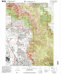
1998 Map of North Ogden
USGS Topo · Published 2001About this map
Ben Lomond dominates the northern horizon of this late-1990s survey, marking the dramatic transition from the high ridges of the Cache National Forest to the urbanized corridor along the Union Pacific rail line. The map captures a moment of significant educational and civic infrastructure, documenting the Ogden Weber Applied Tech Center and the Utah Schools for the Deaf and the Blind. The landscape is a mix of dense residential blocks in North Ogden and Harrisville, and large-scale public venues like the Golden Spike Arena and the Weber County Fairgrounds.
Find a feature on this map
69 named features on this map. Tap any name to fly to it.
Don’t see what you’re looking for? This feature index may not catch every label — zoom into the map to look around manually.
Map Details
Editions of this 1998 North Ogden Map
This is the sole edition of this map. No revisions or reprints were ever made.
Other maps of this area

1954 · Ogden
USGS Topo · 1:250,000

1954 · Brigham City
USGS Topo · 1:250,000

1955 · Ogden
USGS Topo · 1:24,000

1955 · Plain City
USGS Topo · 1:24,000

1955 · Roy
USGS Topo · 1:24,000

1955 · Mantua
USGS Topo · 1:24,000

1955 · Huntsville
USGS Topo · 1:24,000

1955 · James Peak
USGS Topo · 1:24,000

1955 · Willard
USGS Topo · 1:24,000

1955 · North Ogden
USGS Topo · 1:24,000