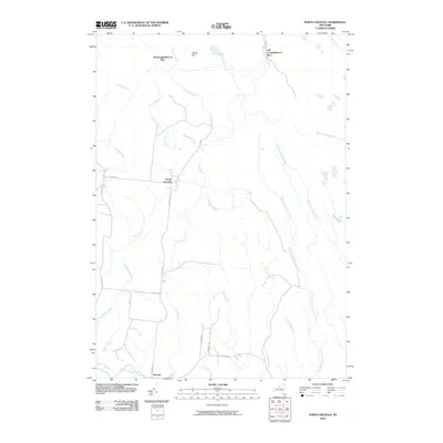
2010 Map of North Osceola
USGS Topo · Published 2010About this map
North Osceola and the nearby hamlet of Osceola anchor this landscape in Lewis County, where a dense network of waterways defines the territory. The map reveals a transition in naming conventions and likely historical rail activity at New Campbellwood Wye and Old Campbellwood Wye, situated in the northern reaches near Wards Hill. These "wye" labels often signify where railroad tracks were once configured for turning locomotives, hinting at the area's industrial or logging heritage.
Find a feature on this map
34 named features on this map. Tap any name to fly to it.
Don’t see what you’re looking for? This feature index may not catch every label — zoom into the map to look around manually.
Map Details
Editions of this 2010 North Osceola Map
This is the sole edition of this map. No revisions or reprints were ever made.
Other maps of this area

1903 · Orwell
USGS Topo · 1:62,500

1905 · Orwell
USGS Topo · 1:62,500

1905 · Taberg
USGS Topo · 1:62,500

1906 · Highmarket
USGS Topo · 1:62,500

1906 · Kasoag
USGS Topo · 1:62,500

1942 · Redfield
USGS Topo · 1:24,000

1943 · Redfield
USGS Topo · 1:31,680

1943 · Westdale
USGS Topo · 1:31,680

1943 · East Florence
USGS Topo · 1:31,680
1943 · Worth Center
USGS Topo · 1:31,680