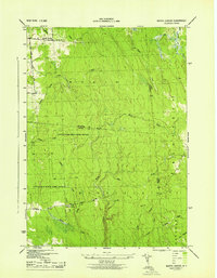
1943 Map of Worth Center
USGS Topo · Published 1943About this map
Worth Center anchors the northern reaches of this 1943 survey, a region defined by the convergence of Oswego, Jefferson, and Lewis counties. The landscape is dominated by the sprawling Littlejohn State Game Refuge, where the terrain transitions from the headwaters of the Mad River to the dense network of tributaries including Abijah Creek and Cottrell Creek. This era of management by the War Department and the Tennessee Valley Authority highlights a sparsely settled timber and recreation territory.
Find a feature on this map
28 named features on this map. Tap any name to fly to it.
Don’t see what you’re looking for? This feature index may not catch every label — zoom into the map to look around manually.
Map Details
Editions of this 1943 Worth Center Map
This is the sole edition of this map. No revisions or reprints were ever made.
Other maps of this area

1895 · Watertown
USGS Topo · 1:62,500

1898 · Watertown
USGS Topo · 1:62,500

1902 · Carthage
USGS Topo · 1:62,500

1903 · Orwell
USGS Topo · 1:62,500

1904 · Carthage
USGS Topo · 1:62,500

1905 · Orwell
USGS Topo · 1:62,500

1906 · Highmarket
USGS Topo · 1:62,500

1908 · Watertown
USGS Topo · 1:62,500

1909 · Watertown
USGS Topo · 1:62,500

1942 · Redfield
USGS Topo · 1:24,000