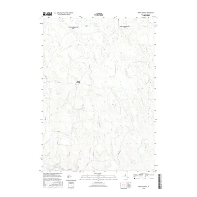
2016 Map of North Osceola
USGS Topo · Published 2016About this map
The Salmon River and its numerous tributaries dominate this Lewis County landscape, defining the character of Osceola and the smaller settlement at North Osceola. The terrain is characterized by a dense network of watercourses, including the W Fork Salmon River and E Fork Salmon River, which converge in a region of significant elevation changes marked by Wards Hill. A unique historical element of the area's layout is found at Old Campbellwood Wye and New Campbellwood Wye, labels that suggest the region's former reliance on complex rail or logging turnarounds. Local travel is facilitated by a grid of rural routes such as N Osceola Rd and Jackson Rd, while the interiors are largely defined by brooks and creeks, from Fall Brook to the secluded waters of Stone Pond.
Find a feature on this map
37 named features on this map. Tap any name to fly to it.
Don’t see what you’re looking for? This feature index may not catch every label — zoom into the map to look around manually.
Map Details
Editions of this 2016 North Osceola Map
This is the sole edition of this map. No revisions or reprints were ever made.
Other maps of this area

1903 · Orwell
USGS Topo · 1:62,500

1905 · Orwell
USGS Topo · 1:62,500

1905 · Taberg
USGS Topo · 1:62,500

1906 · Highmarket
USGS Topo · 1:62,500

1906 · Kasoag
USGS Topo · 1:62,500

1942 · Redfield
USGS Topo · 1:24,000

1943 · Redfield
USGS Topo · 1:31,680

1943 · Westdale
USGS Topo · 1:31,680

1943 · East Florence
USGS Topo · 1:31,680
1943 · Worth Center
USGS Topo · 1:31,680