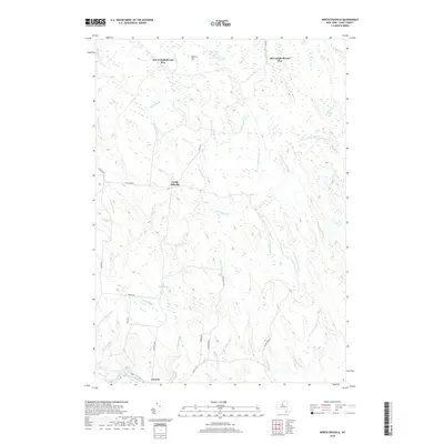
2019 Map of North Osceola
USGS Topo · Published 2019About this map
The Salmon River drainage system dominates this Lewis County landscape, where the settlements of Osceola and North Osceola serve as the primary hubs of human activity. The area is defined by a complex network of waterways, including the W Fork Salmon River and E Fork Salmon River, which converge amidst the dense wetlands and timberlands of the Tug Hill region. The nomenclature of the northern reaches, specifically New Campbellwood Wye and Old Campbellwood Wye, suggests a history tied to the regional rail and logging networks that once shaped this remote part of New York.
Find a feature on this map
37 named features on this map. Tap any name to fly to it.
Don’t see what you’re looking for? This feature index may not catch every label — zoom into the map to look around manually.
Map Details
Editions of this 2019 North Osceola Map
This is the sole edition of this map. No revisions or reprints were ever made.
Other maps of this area

1903 · Orwell
USGS Topo · 1:62,500

1905 · Orwell
USGS Topo · 1:62,500

1905 · Taberg
USGS Topo · 1:62,500

1906 · Highmarket
USGS Topo · 1:62,500

1906 · Kasoag
USGS Topo · 1:62,500

1942 · Redfield
USGS Topo · 1:24,000

1943 · Redfield
USGS Topo · 1:31,680

1943 · Westdale
USGS Topo · 1:31,680

1943 · East Florence
USGS Topo · 1:31,680
1943 · Worth Center
USGS Topo · 1:31,680