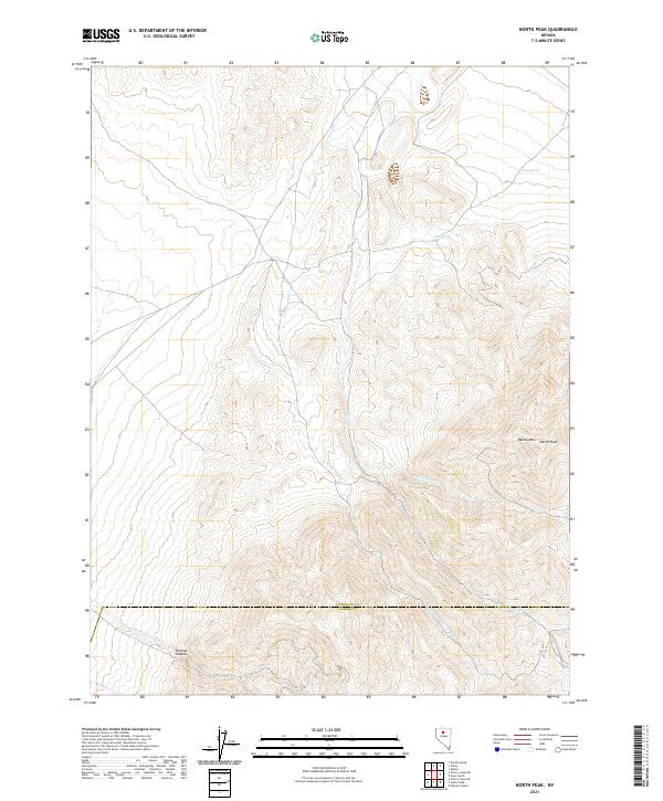
2021 Map of North Peak
USGS Topo · Published 2021About this map
Battle Mtn rises above the high desert of northern Nevada, where the border between Humboldt and Lander Counties cuts across the southern portion of this quadrangle. This landscape is defined by its drainages and isolated water sources, which are critical in this arid environment. Key water features include Cottonwood Cr and Trout Cr, which flow through the center of the sheet, while the N Fork Trout Cr joins the main branch near the eastern slopes of North Peak. For those tracing local landmarks or hydrology, the map identifies specific water points like Ames Spring and Mud Spring. To the southwest, Trenton Canyon and the headwaters of Trenton Cr illustrate the dramatic elevation changes that characterize the region. The map also records the legal and survey divisions of the land, including the boundaries of t33n r42e and t32n r43e.
Find a feature on this map
15 named features on this map. Tap any name to fly to it.
Don’t see what you’re looking for? This feature index may not catch every label — zoom into the map to look around manually.
Map Details
Editions of this 2021 North Peak Map
This is the sole edition of this map. No revisions or reprints were ever made.
Other maps of this area

1932 · Sonoma Range
USGS Topo · 1:250,000

1939 · Sonoma Range
USGS Topo · 1:250,000

1940 · Antler Peak
USGS Topo · 1:62,500

1943 · Antler Peak
USGS Topo · 1:62,500

1955 · Winnemucca
USGS Topo · 1:250,000

1958 · Winnemucca
USGS Topo · 1:250,000

1962 · Winnemucca
USGS Topo · 1:250,000

1965 · Edna Mountain
USGS Topo · 1:62,500
1965 · Brooks Spring
USGS Topo · 1:24,000
1965 · Cherry Creek NE
USGS Topo · 1:24,000