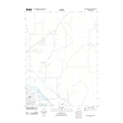
2011 Map of North Platte East
USGS Topo · Published 2011About this map
North Platte serves as the focal point of this 2011 survey, situated at the confluence of transport and terrain in Lincoln County. The eastern reach of the city is defined by a dense street grid including E Railroad St and E Philip Ave, while the landscape to the north and east transitions into the sandhills and rolling elevations of Cavalry Hls and E Rolling Hls. The North Platte River flows through the southern portion of the sheet, mirrored by the winding path of White Horse Creek which meanders through the central plains. Aviation and rural education history are prominent, marked by the extensive North Platte Regional Airport and routes like E Hall School Rd and E Long School Rd. This map captures the settlement of Beck and the suburban expansion moving toward the hills.
Find a feature on this map
38 named features on this map. Tap any name to fly to it.
Don’t see what you’re looking for? This feature index may not catch every label — zoom into the map to look around manually.
Map Details
Editions of this 2011 North Platte East Map
This is the sole edition of this map. No revisions or reprints were ever made.
Other maps of this area

1899 · North Platte
USGS Topo · 1:125,000

1902 · North Platte
USGS Topo · 1:125,000

1954 · North Platte
USGS Topo · 1:250,000

1956 · North Platte
USGS Topo · 1:250,000

1957 · North Platte
USGS Topo · 1:250,000

1967 · North Platte
USGS Topo · 1:250,000

1970 · North Platte East
USGS Topo · 1:24,000

1970 · North Platte West
USGS Topo · 1:24,000
1970 · Maxwell
USGS Topo · 1:24,000
1970 · Maxwell SW
USGS Topo · 1:24,000