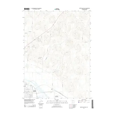
2014 Map of North Platte East
USGS Topo · Published 2014About this map
North Platte serves as the focal point for this study of the central Nebraska landscape, where the urban grid meets the agricultural and aviation infrastructure of the Platte River valley. The eastern edge of the city is detailed along US-30 Byp, stretching from the residential corridors near Calvary Hills Dr and General Dodge Rd down toward the industrial and transport hubs. The North Platte River and its tributary, White Horse Cr, define the drainage patterns that have historically shaped the region's development.
Find a feature on this map
41 named features on this map. Tap any name to fly to it.
Don’t see what you’re looking for? This feature index may not catch every label — zoom into the map to look around manually.
Map Details
Editions of this 2014 North Platte East Map
This is the sole edition of this map. No revisions or reprints were ever made.
Other maps of this area

1899 · North Platte
USGS Topo · 1:125,000

1902 · North Platte
USGS Topo · 1:125,000

1954 · North Platte
USGS Topo · 1:250,000

1956 · North Platte
USGS Topo · 1:250,000

1957 · North Platte
USGS Topo · 1:250,000

1967 · North Platte
USGS Topo · 1:250,000

1970 · North Platte East
USGS Topo · 1:24,000

1970 · North Platte West
USGS Topo · 1:24,000
1970 · Maxwell
USGS Topo · 1:24,000
1970 · Maxwell SW
USGS Topo · 1:24,000