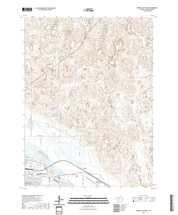
2021 Map of North Platte East
USGS Topo · Published 2021About this map
North Platte serves as the focal point of this Nebraska landscape, where the urban grid meets the agricultural and hydrological systems of Lincoln County. The North Platte River flows through the southern portion of the sheet, paralleled by the community of Beck and the extensive grounds of the North Platte Regional Airport Lee Bird Field. The transport network is a mix of established city streets like Railroad St and rural routes such as Sand Hill Rd, reflecting the area's transition from a rail-hub center to a modern regional transportation node. North of the river, the terrain is defined by the drainage of White Horse Cr and a series of specialized roads, including General Dodge Rd and Fort Moore Dr, which lead into the sandhills-influenced topography that characterizes this part of the Platte River valley.
Find a feature on this map
50 named features on this map. Tap any name to fly to it.
Don’t see what you’re looking for? This feature index may not catch every label — zoom into the map to look around manually.
Map Details
Editions of this 2021 North Platte East Map
This is the sole edition of this map. No revisions or reprints were ever made.
Other maps of this area

1899 · North Platte
USGS Topo · 1:125,000

1902 · North Platte
USGS Topo · 1:125,000

1954 · North Platte
USGS Topo · 1:250,000

1956 · North Platte
USGS Topo · 1:250,000

1957 · North Platte
USGS Topo · 1:250,000

1967 · North Platte
USGS Topo · 1:250,000

1970 · North Platte East
USGS Topo · 1:24,000

1970 · North Platte West
USGS Topo · 1:24,000
1970 · Maxwell
USGS Topo · 1:24,000
1970 · Maxwell SW
USGS Topo · 1:24,000