Loading...
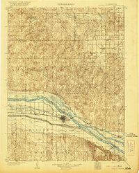
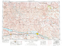
Loading map...1902 Map of North Platte
USGS Topo · Published 1921About this map
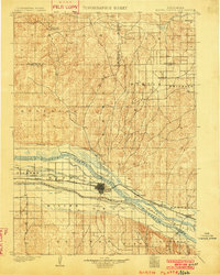
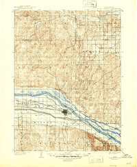
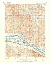
North Platte serves as the focal point of this 1899 survey, situated at the critical junction where complex irrigation networks meet the North Platte River. The landscape reveals a burgeoning agricultural economy defined by an extensive system of waterways, including the Birdwood Canal, Paxton and Hershey Canal, and the Union Pacific Canal. These engineering works, alongside the Union Pacific R. R., illustrate the transformation of the Platte Valley into a managed corridor for transport and farming.
Find a feature on this map
48 named features on this map. Tap any name to fly to it.
Don’t see what you’re looking for? This feature index may not catch every label — zoom into the map to look around manually.
Map Details
Date Portrayed1902
Date Published1921
PublisherU.S. Geological Survey
Map TypeTopographic
Scale1:125,000
Physical Dimensions15.8 x 19.7 inches
Editions of this 1902 North Platte Map
3 editions found
Historical Maps of North Platte Through Time
7 maps found


Featured Locations
Source Details
SourceU.S. Geological Survey
CopyrightPublic Domain