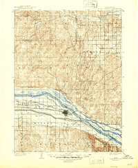
1902 Map of North Platte
USGS Topo · Published 1946About this map
North Platte serves as the central hub of this Nebraska landscape at the turn of the century, positioned strategically where the North Platte River and South Platte River converge. The mapping reveals a sophisticated late-19th-century irrigation network essential for agriculture in the Platte Valley, featuring the Farmers and Merchants Canal, Keith-Lincoln Canal, and the Union Pacific Canal. These waterways underscore the region's transition into a managed agricultural powerhouse.
Find a feature on this map
44 named features on this map. Tap any name to fly to it.
Don’t see what you’re looking for? This feature index may not catch every label — zoom into the map to look around manually.
Map Details
Editions of this 1902 North Platte Map
3 editions found
Other maps of this area

1898 · Paxton
USGS Topo · 1:125,000

1899 · North Platte
USGS Topo · 1:125,000

1901 · Paxton
USGS Topo · 1:125,000

1902 · Gothenburg
USGS Topo · 1:125,000

1902 · North Platte
USGS Topo · 1:125,000

1949 · Cody Lake
USGS Topo · 1:62,500

1949 · Wright Valley
USGS Topo · 1:62,500

1951 · Tryon
USGS Topo · 1:62,500

1951 · Wright Valley
USGS Topo · 1:62,500

1951 · Cody Lake
USGS Topo · 1:62,500