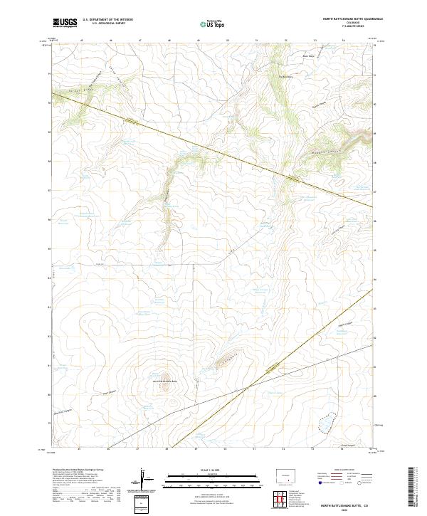
2022 Map of North Rattlesnake Butte
USGS Topo · Published 2022About this map
North Rattlesnake Butte anchors a high plains landscape defined by its intricate network of canyons and vital water management infrastructure at the borders of Pueblo, Huerfano, and Las Animas Counties. The terrain is marked by significant geological features such as the Hogback and Turkey Ridge, while the drainage of Doyle Arroyo and Plum Cr dictates the placement of numerous catchments including Doyle Arroyo Reservoir and Overton Reservoir. This modern survey reveals a region geared toward ranching and water conservation, where family-named and descriptive landmarks like The Beardsley, Madden Canyon, and Bobbins Pocket Spring provide essential orientation in an arid environment. The map details the local road network, including Co RD 125 and Co RD 130, which navigate around deep incisions such as Tinaja Canyon and Sheep Canyon, illustrating how the physical geography of southern Colorado continues to shape human movement and land use.
Find a feature on this map
60 named features on this map. Tap any name to fly to it.
Don’t see what you’re looking for? This feature index may not catch every label — zoom into the map to look around manually.
Map Details
Editions of this 2022 North Rattlesnake Butte Map
This is the sole edition of this map. No revisions or reprints were ever made.
Other maps of this area

1891 · Walsenburg
USGS Topo · 1:125,000

1891 · Apishapa
USGS Topo · 1:125,000

1893 · Apishapa
USGS Topo · 1:125,000

1894 · Walsenburg
USGS Topo · 1:125,000

1897 · Walsenburg
USGS Topo · 1:125,000

1897 · Apishapa
USGS Topo · 1:125,000

1900 · Walsenburg
USGS Topo · 1:125,000

1954 · Trinidad
USGS Topo · 1:250,000

1955 · Trinidad
USGS Topo · 1:250,000

1958 · Trinidad
USGS Topo · 1:250,000