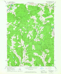
1965 Map of North Sanford
USGS Topo · Published 1967About this map
Susquehanna River valley life and upland timber harvesting define this 1965 look at the borderlands where Chenango, Delaware, and Broome counties meet. The landscape is dominated by expansive state-protected lands, including Afton State Forest and Masonville State Forest, which surround the primary corridors of Oquaga Creek and Masonville Creek. Settlement patterns favor the valley floors, with small crossroads like North Sanford and Masonville serving as local hubs.
Find a feature on this map
65 named features on this map. Tap any name to fly to it.
Don’t see what you’re looking for? This feature index may not catch every label — zoom into the map to look around manually.
Map Details
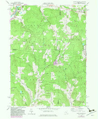
Editions of this 1965 North Sanford Map
2 editions found
Other maps of this area

1902 · Coventry
USGS Topo · 1:62,500

1904 · Oxford
USGS Topo · 1:62,500

1905 · Nineveh
USGS Topo · 1:62,500

1915 · Unadilla
USGS Topo · 1:62,500

1918 · Unadilla
USGS Topo · 1:62,500

1924 · Deposit
USGS Topo · 1:62,500

1926 · Deposit
USGS Topo · 1:62,500

1943 · Sidney
USGS Topo · 1:24,000
1943 · Unadilla
USGS Topo · 1:24,000

1944 · Deposit
USGS Topo · 1:62,500