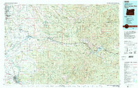
1983 Map of North Santiam River
USGS Topo · Published 1984About this map
Silver Falls State Park and the expansive Santiam State Forest anchor this early 1980s view of the western Cascades foothills. The transition from the fertile Willamette Valley floor—home to Salem, Turner, and Stayton—into the high timberlands of the Mount Hood National Forest and Willamette National Forest is clearly defined. Along the canyon of the North Santiam River, timber-reliant communities like Mill City, Gates, and Idanha serve as primary hubs for the river-and-rail corridor, where the Southern Pacific railroad lines wind through the valley floor toward the mountains.
Find a feature on this map
104 named features on this map. Tap any name to fly to it.
Don’t see what you’re looking for? This feature index may not catch every label — zoom into the map to look around manually.
Map Details
Editions of this 1983 North Santiam River Map
This is the sole edition of this map. No revisions or reprints were ever made.
Other maps of this area

1911 · Brownsville
USGS Topo · 1:31,680

1911 · Lebanon
USGS Topo · 1:31,680

1911 · Tangent
USGS Topo · 1:31,680

1912 · Jefferson
USGS Topo · 1:31,680

1912 · Halsey
USGS Topo · 1:62,500

1915 · Eola
USGS Topo · 1:31,680

1915 · Sidney
USGS Topo · 1:31,680

1916 · Albany
USGS Topo · 1:62,500

1916 · Estacada
USGS Topo · 1:125,000

1917 · Salem
USGS Topo · 1:62,500