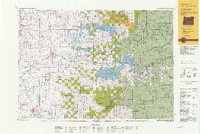
1991 Map of North Santiam River
USGS Topo · Published 1993About this map
The North Santiam River serves as the central artery for this diverse landscape, winding from the Cascade foothills through the agricultural valleys of Marion and Linn counties. During the early 1990s, the region demonstrates a complex pattern of land use, from the urban fringes of Salem and Four Corners to the dense timberlands of the Willamette National Forest. The transition from the valley floor to the high country is marked by the Waldo Hills and prominent peaks like Snow Peak and Sardine Mtn.
Find a feature on this map
78 named features on this map. Tap any name to fly to it.
Don’t see what you’re looking for? This feature index may not catch every label — zoom into the map to look around manually.
Map Details
Editions of this 1991 North Santiam River Map
This is the sole edition of this map. No revisions or reprints were ever made.
Other maps of this area

1911 · Brownsville
USGS Topo · 1:31,680

1911 · Lebanon
USGS Topo · 1:31,680

1911 · Tangent
USGS Topo · 1:31,680

1912 · Jefferson
USGS Topo · 1:31,680

1912 · Halsey
USGS Topo · 1:62,500

1915 · Eola
USGS Topo · 1:31,680

1915 · Sidney
USGS Topo · 1:31,680

1916 · Albany
USGS Topo · 1:62,500

1916 · Estacada
USGS Topo · 1:125,000

1917 · Salem
USGS Topo · 1:62,500