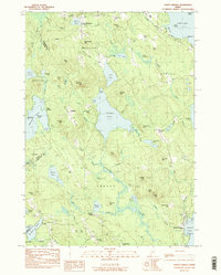
1983 Map of North Sebago
USGS Topo · Published 1984About this map
The waters of Peabody Pond and the Northwest River define the interior of this Maine landscape, where numerous small ponds like Holt Pond and Cold Rain Pond dot the terrain between rising peaks. This provisional survey captures the late 20th-century settlement pattern in towns such as Sebago Center and North Sebago, reflecting a region deeply tied to its wooded uplands and glacial lakes. Family history is well-preserved across the map through a dense network of burial sites, including the Palmer-Ingalls Cem, Babb Cem, and Haley Cem.
Find a feature on this map
106 named features on this map. Tap any name to fly to it.
Don’t see what you’re looking for? This feature index may not catch every label — zoom into the map to look around manually.
Map Details
Editions of this 1983 North Sebago Map
3 editions found
Other maps of this area

1896 · Norway
USGS Topo · 1:62,500

1896 · Sebago
USGS Topo · 1:62,500

1909 · Fryeburg
USGS Topo · 1:62,500

1910 · Kezar Falls
USGS Topo · 1:48,000

1911 · Fryeburg
USGS Topo · 1:62,500

1911 · Kezar Falls
USGS Topo · 1:62,500

1941 · Fryeburg
USGS Topo · 1:62,500

1942 · Sebago Lake
USGS Topo · 1:62,500

1943 · Sebago Lake
USGS Topo · 1:62,500

1946 · Norway
USGS Topo · 1:62,500