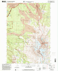
1997 Map of North Sister
USGS Topo · Published 2001About this map
North Sister and Middle Sister dominate this high-altitude landscape along the border of Lane and Deschutes counties. The terrain is defined by volcanic activity, featuring extensive lava fields and distinctive features like the Ahalapam Cinder Field, Four In One Cone, and the jagged Obsidian Cliffs. The Pacific Crest National Scenic Trail winds through these summits, passing Matthieu Lakes and crossing over Opie Dilidock Pass. Numerous glaciers, including the Collier Glacier and Renfrew Glacier, are mapped in detail on the mountain flanks. Deep in the Three Sisters Wilderness, commemorative markers such as the Bronaugh Memorial Plaque and Prouty Memorial Plaque reflect the area's legacy of exploration and mountaineering within the Willamette National Forest.
Find a feature on this map
68 named features on this map. Tap any name to fly to it.
Don’t see what you’re looking for? This feature index may not catch every label — zoom into the map to look around manually.
Map Details
Editions of this 1997 North Sister Map
This is the sole edition of this map. No revisions or reprints were ever made.
Other maps of this area

1929 · Three Sisters
USGS Topo · 1:125,000

1932 · Three Sisters
USGS Topo · 1:125,000

1955 · Bend
USGS Topo · 1:250,000

1957 · Bend
USGS Topo · 1:250,000

1958 · Bend
USGS Topo · 1:250,000

1959 · Broken Top
USGS Topo · 1:62,500
1959 · Three Sisters
USGS Topo · 1:62,500

1959 · Three Fingered Jack
USGS Topo · 1:62,500

1959 · Sisters
USGS Topo · 1:62,500
1980 · Bend
USGS Topo · 1:100,000