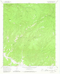
1965 Map of North Star Mesa
USGS Topo · Published 1980About this map
Gila National Forest encompasses this high-elevation terrain in Grant County, where the Continental Divide winds through the eastern portion of the quadrangle. The map documents a landscape defined by deep drainage systems like Slick Rock Canyon, Cienega Canyon, and Sapillo Creek, which flows along the southern edge near Gattons Park. Human activity is marked by the presence of the V Cross Ranch and the Rocky Canyon Campground, suggesting a mix of livestock ranching and recreational use in the mid-1960s.
Find a feature on this map
28 named features on this map. Tap any name to fly to it.
Don’t see what you’re looking for? This feature index may not catch every label — zoom into the map to look around manually.
Map Details
Editions of this 1965 North Star Mesa Map
2 editions found
Other maps of this area

1909 · Silver City
USGS Topo · 1:125,000

1911 · Alum Mountain
USGS Topo · 1:125,000

1913 · Alum Mountain
USGS Topo · 1:125,000

1947 · Allie Canyon
USGS Topo · 1:24,000

1947 · Twin Sisters
USGS Topo · 1:24,000

1948 · Twin Sisters
USGS Topo · 1:24,000

1948 · Allie Canyon
USGS Topo · 1:24,000

1954 · Tularosa
USGS Topo · 1:250,000

1954 · Silver City
USGS Topo · 1:250,000

1954 · Clifton
USGS Topo · 1:250,000