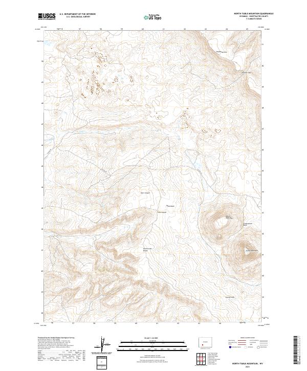
2021 Map of North Table Mountain
USGS Topo · Published 2021About this map
The Continental Divide winds through this high-altitude landscape in Sweetwater County, marking a high point between the Leucite Hills and the prominent volcanic landmarks of the area. The map is defined by the sharp elevations of North Table Mtn and South Table Mtn, which rise above the surrounding flats and drainage systems like Table Wash and Greasewood Wash. These landforms indicate the unique geological character of the region, where flat-topped mesas and deep incisions like Deer Canyon and Pine Canyon create a complex topography. Human presence is limited to the winding track of Chilton Rd, which navigates the variable terrain near Nitch Cr. To the north, the elevation culminates at Steamboat Rim and Johnson Gap, providing a clear view of the structural transitions in this part of the Wyoming desert.
Find a feature on this map
16 named features on this map. Tap any name to fly to it.
Don’t see what you’re looking for? This feature index may not catch every label — zoom into the map to look around manually.
Map Details
Editions of this 2021 North Table Mountain Map
This is the sole edition of this map. No revisions or reprints were ever made.
Other maps of this area

1954 · Rock Springs
USGS Topo · 1:250,000

1955 · Lander
USGS Topo · 1:250,000

1958 · Lander
USGS Topo · 1:250,000

1958 · Rock Springs
USGS Topo · 1:250,000

1958 · Essex Mountain
USGS Topo · 1:62,500

1958 · Boars Tusk
USGS Topo · 1:62,500

1958 · Freighter Gap
USGS Topo · 1:62,500

1958 · Superior
USGS Topo · 1:62,500

1961 · Lander
USGS Topo · 1:250,000

1962 · Rock Springs
USGS Topo · 1:250,000