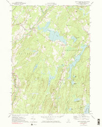
1970 Map of North Whitefied
USGS Topo · Published 1983About this map
North Whitefield and South Jefferson anchor this landscape of glacial ponds and interconnected waterways in the Maine interior. The central focus is the dramatic north-south corridor of Long Dyer Pond and the Sheepscot River, where the terrain rises toward heights like Jones Hill and Brooks Turner Hill. For those researching local history, the map preserves the locations of numerous community institutions, from St Denis Ch and Whitefield Sch to several family-named burial grounds like Trask Lawn Cem and Weeks Cem. The area’s hydrology is well-documented, featuring smaller basins such as Little Dyer Pond, Weary Pond, and Musquash Pond. The presence of several Gravel Pits and a Gaging Sta near the river suggests the modest industrial and monitoring activities that supported the local economy and infrastructure at the turn of the 1970s.
Find a feature on this map
55 named features on this map. Tap any name to fly to it.
Don’t see what you’re looking for? This feature index may not catch every label — zoom into the map to look around manually.
Map Details
Editions of this 1970 North Whitefied Map
3 editions found
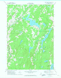
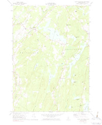
Other maps of this area

1893 · Vassalboro
USGS Topo · 1:62,500

1893 · Wiscasset
USGS Topo · 1:62,500

1898 · Vassalboro
USGS Topo · 1:62,500

1913 · Waldoboro
USGS Topo · 1:48,000

1915 · Waldoboro
USGS Topo · 1:62,500

1916 · Liberty
USGS Topo · 1:62,500

1941 · Waldoboro
USGS Topo · 1:62,500

1941 · Vassalboro
USGS Topo · 1:62,500

1942 · Liberty
USGS Topo · 1:62,500

1943 · Vassalboro
USGS Topo · 1:62,500