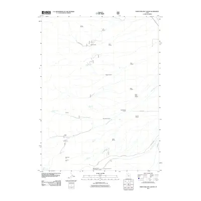
2011 Map of North Willow Canyon
USGS Topo · Published 2011About this map
Mining claims and deep drainage networks characterize this high-altitude landscape in the Stansbury Mountains. Several named operations, including the Western Star Mine and Metal Queen Mine, are clustered along the western slopes, providing a look at the historical mineral extraction that once drove the local economy. The terrain is deeply incised by major channels such as North Willow Canyon and Magpie Canyon, which gather water from remote points like Magpie Canyon Spring and White Rock Spring. Near the southern boundary, the Mining Fork of South Willow Canyon leads toward the Cottonwood Campground, where recreation meets the remnants of industrial history. At the higher elevations, the North Willow Lake sits nestled above a series of steep descents, while the historical corridor of the Mormon Trl marks the eastern edge of the quadrangle.
Find a feature on this map
32 named features on this map. Tap any name to fly to it.
Don’t see what you’re looking for? This feature index may not catch every label — zoom into the map to look around manually.
Map Details
Editions of this 2011 North Willow Canyon Map
This is the sole edition of this map. No revisions or reprints were ever made.
Other maps of this area

1885 · Tooele Valley
USGS Topo · 1:250,000

1918 · Stockton
USGS Topo · 1:62,500

1953 · Tooele
USGS Topo · 1:250,000

1955 · Timpie
USGS Topo · 1:62,500

1955 · Deseret Peak
USGS Topo · 1:62,500

1955 · Burmester
USGS Topo · 1:24,000

1955 · Grantsville
USGS Topo · 1:24,000

1955 · Stockton
USGS Topo · 1:62,500

1955 · Tooele
USGS Topo · 1:250,000
1972 · Burmester
USGS Topo · 1:24,000