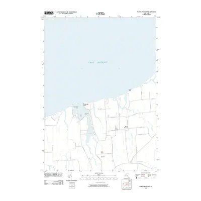
2010 Map of North Wolcott
USGS Topo · Published 2010About this map
Lake Ontario defines the northern reaches of this Wayne County landscape, where the shoreline is marked by prominent landforms such as Scotts Bluff and Negrohead Point. The interior is characterized by the tidal inlets and marshes of Port Bay and Brush Marsh, which are fed by several local waterways including Wolcott Creek and Beaver Creek. The settlement at North Wolcott serves as the inland hub, surrounded by a grid of rural roads named for local families and landmarks, such as Hapeman Rd and Wadsworth Street Rd. For those researching local lineages, the map includes several burial grounds like North Wolcott Cemetery and the Joiner-Wheeler Cemetery. The area's agricultural identity is visible through features like Haywoods Fruit Farm, while recreational spots such as Desbrough Park near Loon Point offer a glimpse into the lakeside lifestyle of the early twenty-first century.
Find a feature on this map
45 named features on this map. Tap any name to fly to it.
Don’t see what you’re looking for? This feature index may not catch every label — zoom into the map to look around manually.
Map Details
Editions of this 2010 North Wolcott Map
This is the sole edition of this map. No revisions or reprints were ever made.
Other maps of this area

1900 · Oswego
USGS Topo · 1:62,500

1902 · Sodus Bay
USGS Topo · 1:62,500

1902 · Clyde
USGS Topo · 1:62,500

1902 · Weedsport
USGS Topo · 1:62,500

1943 · Sodus Point
USGS Topo · 1:31,680

1943 · Fair Haven
USGS Topo · 1:31,680

1943 · Wolcott
USGS Topo · 1:31,680
1943 · Rose
USGS Topo · 1:31,680
1943 · Red Creek
USGS Topo · 1:31,680
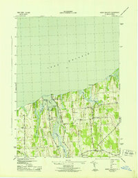
1943 · North Wolcott
USGS Topo · 1:31,680