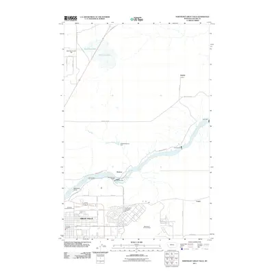
2011 Map of Northeast Great Falls
USGS Topo · Published 2011About this map
The Missouri River carves a dramatic industrial and natural path through this section of Montana, defined by a series of significant hydroelectric and hydrological features. The river's descent is marked by Rainbow Dam, Cochrane Dam, and Morony Dam, which harnessed the same currents that create the nearby Rainbow Falls and Crooked Falls. Along the southern banks, the urban expansion of Great Falls meets the sprawling grounds of Malmstrom Air Force Base. To the north, the landscape transitions into the open terrain of Black Horse Lake Flat and the ephemeral Black Horse Lake. This 2011 survey captures the intersection of heavy infrastructure and geologic landmarks like Giant Springs, illustrating how the Missouri's water power has been meticulously managed to support the region's energy and municipal needs.
Find a feature on this map
39 named features on this map. Tap any name to fly to it.
Don’t see what you’re looking for? This feature index may not catch every label — zoom into the map to look around manually.
Map Details
Editions of this 2011 Northeast Great Falls Map
This is the sole edition of this map. No revisions or reprints were ever made.
Other maps of this area

1886 · Great Falls
USGS Topo · 1:250,000

1948 · Portage
USGS Topo · 1:62,500

1949 · Portage
USGS Topo · 1:62,500

1949 · Great Falls
USGS Topo · 1:62,500

1951 · Great Falls
USGS Topo · 1:62,500

1954 · Great Falls
USGS Topo · 1:250,000

1955 · Stockett
USGS Topo · 1:62,500

1955 · Gore Hill
USGS Topo · 1:62,500

1957 · Great Falls
USGS Topo · 1:250,000
1965 · Floweree
USGS Topo · 1:24,000