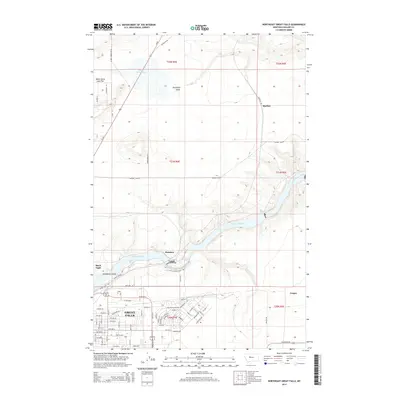
2014 Map of Northeast Great Falls
USGS Topo · Published 2014About this map
The Missouri River carves a deep valley through this portion of Cascade County, defining the northern industrial and residential expansion of Great Falls. This 2014 survey captures the distinct transition from the dense urban grid of the city, including Central Ave and 10th Ave N, to the surrounding agricultural and industrial districts like Black Eagle and Rainbow. The river's path is marked by significant hydrological landmarks such as Giant Springs and the cascading waters of Rainbow Falls, which are bypassed by the Rainbow Falls Bridge.
Find a feature on this map
62 named features on this map. Tap any name to fly to it.
Don’t see what you’re looking for? This feature index may not catch every label — zoom into the map to look around manually.
Map Details
Editions of this 2014 Northeast Great Falls Map
This is the sole edition of this map. No revisions or reprints were ever made.
Other maps of this area

1886 · Great Falls
USGS Topo · 1:250,000

1948 · Portage
USGS Topo · 1:62,500

1949 · Portage
USGS Topo · 1:62,500

1949 · Great Falls
USGS Topo · 1:62,500

1951 · Great Falls
USGS Topo · 1:62,500

1954 · Great Falls
USGS Topo · 1:250,000

1955 · Stockett
USGS Topo · 1:62,500

1955 · Gore Hill
USGS Topo · 1:62,500

1957 · Great Falls
USGS Topo · 1:250,000
1965 · Floweree
USGS Topo · 1:24,000