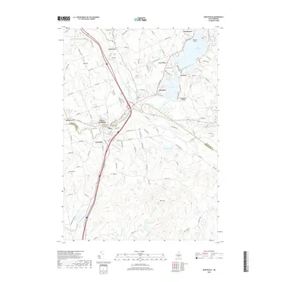
2018 Map of Northfield
USGS Topo · Published 2018About this map
Lake Winnisquam and the Winnipesaukee River corridor anchor this 2018 study of the Lakes Region, where the historical boundary between Belknap and Merrimack Counties follows the river's path. The twin settlements of Tilton and Northfield serve as the primary population centers, connected by the notable Tilton Island Park Bridge. Smaller communities such as Sanbornton, Lochmere, and East Tilton are interspersed among a landscape defined by significant elevations like Bean Hill and Mt Tug. For local historians, the presence of Sanbornton Cem, Saint Johns Cem, and Arch Cem provides clear reference points for genealogical research. The map captures a mix of residential development around Silver Lake and Gardners Grove contrasted with more rural reaches toward Forest Pond and the Hogg River, illustrating the modern balance of central New Hampshire's lake-and-river geography.
Find a feature on this map
119 named features on this map. Tap any name to fly to it.
Don’t see what you’re looking for? This feature index may not catch every label — zoom into the map to look around manually.
Map Details
Editions of this 2018 Northfield Map
This is the sole edition of this map. No revisions or reprints were ever made.
Other maps of this area

1909 · Winnepesaukee
USGS Topo · 1:62,500

1919 · Gilmanton
USGS Topo · 1:62,500

1925 · Holderness
USGS Topo · 1:62,500

1927 · Penacook
USGS Topo · 1:62,500

1927 · Gilmanton
USGS Topo · 1:62,500

1927 · Holderness
USGS Topo · 1:62,500

1949 · Portland
USGS Topo · 1:250,000

1956 · Winnipesaukee
USGS Topo · 1:62,500

1956 · Penacook
USGS Topo · 1:62,500

1956 · Holderness
USGS Topo · 1:62,500